Śnieżka - Karkonosze National Park
No weather data
0.0 /5
Number of ratings: 0
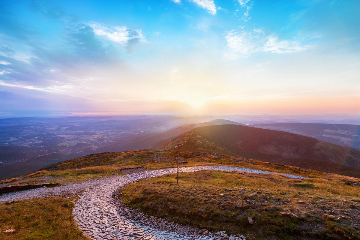
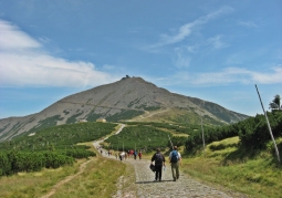
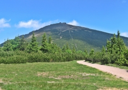
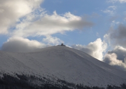
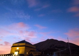
Śnieżka is the highest peak of the Karkonosze and the entire Sudetes Mountains measuring 1602 m above sea level, rising 200 m above Równia pod Śnieżką. Most of the massif is built of very hard and resistant to destruction rocks called hornfels - metamorphic rocks, resulting from the transformation of shale as a result of the impact of intruding granite magma in the Carboniferous period. The Śnieżka peak is characterized by a very harsh climate, low temperature, even in summer, often with strong winds and considerable cloudiness. Śnieżka is considered the windiest place on the European continent. Snow cover stays there very long, almost 200 days a year. The following tourist routes lead to Śnieżka: - red - to the Okraj Pass and Równia pod Śnieżką - Road of Polish-Czech Friendship, - black - to Karpacz via the Silesian Road - blue - to the Okraj Pass through the Rock Table and to Karpacz through Mały Staw - yellow - Velká Úpa along the chair lift (Czech) On the top of Śnieżka there is the Chapel of St. Wawrzyniec, dating from 1681, as well as the IMGiW meteorological observatory.
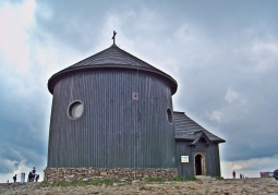
Chapel of St. Wawrzyniec
Category: ChurchesThe oldest object located on Śnieżka - the highest hill of the Sudetes. The building was erected in 1655, on the initiative of the founder Count Krzysztof Schoffgotsch. The building was consecrated on August 10, 1681....
Komentarze
No results
Nearby places
Chapel of St. Wawrzyniec - Śnieżka - Karkonosze National Park
Category: ChurchesThe oldest object located on Śnieżka - the highest hill of the Sudetes. The building was erected in 1655, on the initiative of the founder Count Krzysztof Schoffgotsch. The building was consecrated on August 10, 1681....
1 km
Równia pod Śnieżką - Karkonosze National Park
Category: Peaks and valleysThe plateau lies at an altitude of 1350 m to 1444 m a.s.l. on the ridge of the Karkonosze Mountains under the highest mountain in the Sudetes, Śnieżka, it stretches over the Łomniczki and Mały Stawu boilers, Biały...
3 km
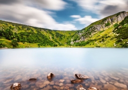
Small Pond - Karkonosze National Park
Category: Lakes, springs, waterfallsMały Staw is a mountain flow lake, filling the bottom of a glacial boiler, located at an altitude (1,183 m a.s.l.). It has a depth of up to 7.3 m, shoreline length 756 m and covers an area of 2.881 ha. The lake...
4 km
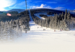
Kopa Ski Complex - Karpacz
Category: Ski resortsThe ski resort is located in Karpacz in the Giant Mountains on the northern slopes of the Kopa Mountain (1377 m a.s.l.) and in the Złotówka Glade (1252 m a.s.l.), between which the White Jar cuts in. Kopa is a small...
4 km

Nearby places
Chapel of St. Wawrzyniec - Śnieżka - Karkonosze National Park
Category: ChurchesThe oldest object located on Śnieżka - the highest hill of the Sudetes. The building was erected in 1655, on the initiative of the founder Count Krzysztof Schoffgotsch. The building was consecrated on August 10, 1681....
1 km
Równia pod Śnieżką - Karkonosze National Park
Category: Peaks and valleysThe plateau lies at an altitude of 1350 m to 1444 m a.s.l. on the ridge of the Karkonosze Mountains under the highest mountain in the Sudetes, Śnieżka, it stretches over the Łomniczki and Mały Stawu boilers, Biały...
3 km
Small Pond - Karkonosze National Park
Category: Lakes, springs, waterfallsMały Staw is a mountain flow lake, filling the bottom of a glacial boiler, located at an altitude (1,183 m a.s.l.). It has a depth of up to 7.3 m, shoreline length 756 m and covers an area of 2.881 ha. The lake...
4 km
Kopa Ski Complex - Karpacz
Category: Ski resortsThe ski resort is located in Karpacz in the Giant Mountains on the northern slopes of the Kopa Mountain (1377 m a.s.l.) and in the Złotówka Glade (1252 m a.s.l.), between which the White Jar cuts in. Kopa is a small...
4 km